At a remote airfield, a paragliding launch or a wilderness site — a live photo tells you instantly what no weather sensor number can. PIXWeather delivers two-direction HD images every 10–30 minutes, alongside full weather data, from anywhere the sun shines and a 4G signal exists.
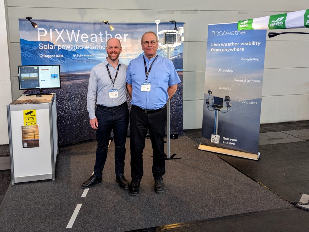
Thank you for a great AERO 2026
Welcome — and thank you for stopping by booth B2-102 in Friedrichshafen. We'd love to continue the conversation about how PIXWeather fits your airfield, flying club, or operation. Use code AERO2026 for 25% off your station.
Remote, off-grid and exposed. Wherever a weather decision matters and the nearest power line is out of reach, PIXWeather is already there.
Pilots check the live strip, approach and sky before they drive to the field. One photo says more than a METAR from 80 km away.
A live image from the exact take-off point, with wind speed and gusts overlaid, lets clubs make safe go/no-go calls.
Autonomous, long-term data collection at wilderness sites, nature reserves and research stations — no field visits required.
Live coastal conditions for windsurfers, kitesurfers and harbour masters. Solar power means no shore infrastructure needed.
Live frost, wind and visibility at exposed holes. Reposition the station between greens with no wiring or permits.
Automatic two-direction timelapse of any project. Live wind covers crane operations. Move the station as the project advances.
Remote sites need visual confirmation, structured weather data, power independence and cellular connectivity — all at once. Every alternative solves only one of those.
The places that need real-time weather data most are exactly the places with no infrastructure to deliver it. Until now.
At an uncontrolled aerodrome, a single image of the strip, the approach and the sky is worth more than any METAR or weather info far away. PIXWeather delivers HD photos in two directions every 10–30 minutes alongside live wind, pressure and visibility data. Pilots see exactly what the conditions looks like right now — before they go there.
Conditions at a launch site can be completely different from the valley below. A live image from the exact takeoff point — with wind speed, direction and gusts overlaid — lets pilots make safe go/no-go calls before leaving home. Share the live feed with the whole flying club.
Long-term autonomous data collection at wilderness sites, nature reserves, river catchments and research stations. Wind, temperature, humidity and pressure stream continuously to the cloud — with periodic visual confirmation images that no field visit can replicate at the same frequency or cost.
A live image of the coastal approach or beach tells windsurfers and kitesurfers exactly what conditions look like before they rig up. Harbour masters monitor sea state and visibility at exposed approaches. Solar-powered means no shore power required at remote headlands.
Two-direction images on a regular schedule create an automatic visual timelapse of any project — road, bridge or building — documenting progress and current status at any point in time. Live wind data covers crane operations. Move the station as the project advances with no infrastructure required.
Frost alerts and hyperlocal microclimate data — where the difference between crop loss and a successful harvest can be a few degrees at 3 am. Deploy between vineyard rows with no electrician, no wiring and no permits for power infrastructure.
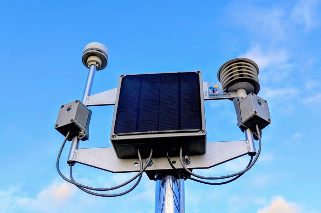
No cables. No electrician. No permits. No software install. The moment you mount the station on the pole, your images and data start flowing to your phone.
Fix on the pole. Point the solar panel to the south (180°) and adjust the cameras the selected directions.
Single button. The station connects to the strongest local 4G carrier automatically.
Open the app on iOS, Android or stations website. First HD images and weather reading start to arrive in few minutes.
Every component chosen for reliability in environments where the nearest technician is hours away. Proven from the Arctic to the tropics.
Powered entirely by sunlight. A high-capacity onboard battery stores enough energy to operate through extended overcast periods and polar winters. Truly autonomous — no site visits, no battery replacements.
Dual HD cameras capture images in two directions every 10–30 minutes throughout daylight. Wind speed, direction, temperature and sitename are embedded into each image — full situational awareness at a glance.
No moving parts means no mechanical failure, no icing and no calibration drift. Accurate across the full speed range — the anemometer that never needs attention.
A global multi-network SIM roams to the strongest available carrier. Data and images reach your app within seconds of being recorded — from anywhere with any cellular coverage across 190+ countries.
No wiring. No electrician. No permits for power. Mount the station on the pole, orient the panel, and data starts flowing. The entire installation takes few minutes anywhere in the world.
Access to data can be by a REST endpoint for integrating data and images into flight planning, dashboards, research platforms or BMS systems.
API documentation by requestOne station purchase — everything included. The first year of data and support is bundled in. After that, only a small annual subscription keeps your feed live.
Your card is charged 1.999 € today. Your first year of data & support is included. After 12 months, the subscription renews automatically (199 € / year with 1 year free trial).
The PIXWeather Station price is all-inclusive. You get the hardware, dual HD cameras, ultrasonic anemometer, solar panel, battery, 4G/LTE SIM, DDP delivery to your door, and the entire first year of data, cloud storage and technical support. One price, one invoice, no hidden charges at delivery.
Your first year of data & support is already included in the Station price — you pay nothing extra for the first 12 months. From month 13 onwards, the annual Data & Support Subscription renews automatically, charged to the card you used at checkout via Teya. No action required on your side. You can cancel anytime from your account dashboard.
If your card declines at renewal time, we send you an email immediately and retry the payment on a defined schedule (usually 2, 5, and 14 days later). If all retries fail, data transmission pauses — but your station hardware is yours permanently and no data is deleted. The moment you update your payment method, service resumes and your complete image archive becomes available again.
Yes — for B2B orders we can issue a proforma invoice for bank transfer. Please contact us at info@pixweather.io with your company details and we'll set it up before shipping. Card payment via Teya is the default and fastest option.
Yes. At checkout, enter your valid EU VAT number. The site validates it against VIES (the EU's VAT Information Exchange System) and, if your billing country differs from ours, applies the reverse-charge mechanism — no VAT is collected at point of sale and you account for it in your own return. The invoice clearly marks "VAT reverse-charged".
Of course. Email info@pixweather.io with your requirements (quantity, destination country, any custom installation needs) and we'll respond with a formal quote the same business day.
For private buyers, we ship DDP (Delivered Duty Paid) — we prepay all import duties, customs clearance and destination VAT. Your station arrives at your door with zero additional charges. For EU companies with a valid VAT number, the reverse-charge mechanism applies: enter your VAT number at checkout, pay 0% VAT, and account for it in your own return. The invoice clearly marks "VAT reverse-charged". Express delivery is included in the price for all orders.
Images are taken every 10 or 30 minutes during daylight — dynamically controlled byt the station. Each image from both cameras has wind speed, temperature, timestamp and place embedded directly in the photo.
The station uses a global multi-network SIM that automatically connects to whichever carrier has the strongest available signal. It works wherever any 4G/LTE coverage exists across 190+ countries.
PIXWeather has operated continuously through Arctic winters — months of near-darkness and temperatures well below −20°C, snow and strong winds — without interruption. The battery is specifically sized for extended low-light operation.
Yes. A REST API is available for subscribers integrating data and images into flight planning systems, dashboards, research platforms or building management software. Documentation available by request.
Yes, anytime from your account dashboard. Your station hardware remains yours permanently. If you cancel, data transmission pauses when the current billing period ends — no pro-rated refund, but you keep full access through to the end of the period you've paid for.